Note
Click here to download the full example code
Point Spatial Model
This model is a delta function centered in lon_0 and lat_0 parameters provided:
\[\phi(lon, lat) = \delta{(lon - lon_0, lat - lat_0)}\]
The model is defined on the celestial sphere in the coordinate frame provided by the user.
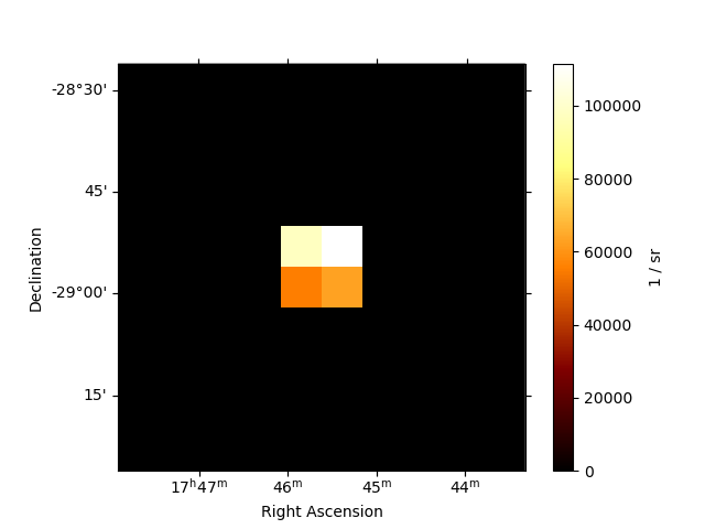
If the point source is not centered on a pixel, the flux is re-distributed across 4 neighbouring pixels. This ensured that the center of mass position is conserved.
Example plot
Here is an example plot of the model:
from astropy.coordinates import SkyCoord
from gammapy.maps import WcsGeom
from gammapy.modeling.models import (
    Models,
    PointSpatialModel,
    PowerLawSpectralModel,
    SkyModel,
)

model = PointSpatialModel(lon_0="0.01 deg", lat_0="0.01 deg", frame="galactic",)

geom = WcsGeom.create(
    skydir=SkyCoord("0d 0d", frame="galactic"), width=(1, 1), binsz=0.1
)
model.plot(geom=geom, add_cbar=True)

YAML representation
Here is an example YAML file using the model:
Out:
components:
-   name: pwl-point-model
    type: SkyModel
    spectral:
        type: PowerLawSpectralModel
        parameters:
        - {name: index, value: 2.0, unit: '', min: .nan, max: .nan, frozen: false}
        - {name: amplitude, value: 1.0e-12, unit: cm-2 s-1 TeV-1, min: .nan, max: .nan,
            frozen: false}
        - {name: reference, value: 1.0, unit: TeV, min: .nan, max: .nan, frozen: true}
    spatial:
        type: PointSpatialModel
        frame: icrs
        parameters:
        - {name: lon_0, value: 0.0, unit: deg, min: .nan, max: .nan, frozen: false}
        - {name: lat_0, value: 0.0, unit: deg, min: -90.0, max: 90.0, frozen: false}